Page 3 of 4
RE:WL.com High lakes photo collection
Posted: Thu Oct 01, 2009 7:25 pm
by SAPIplate
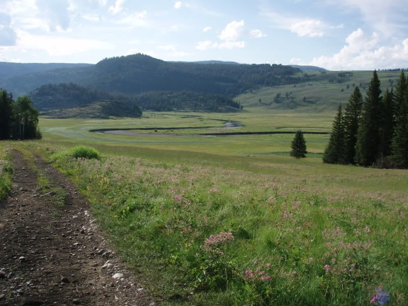
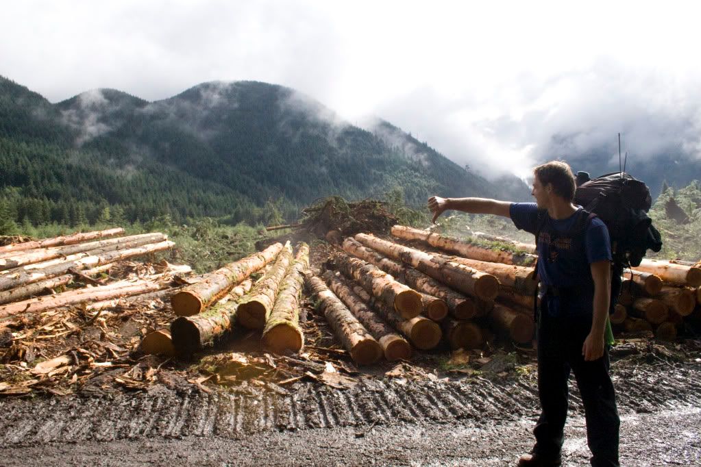
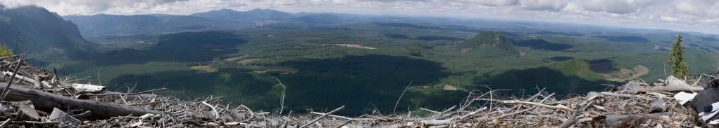
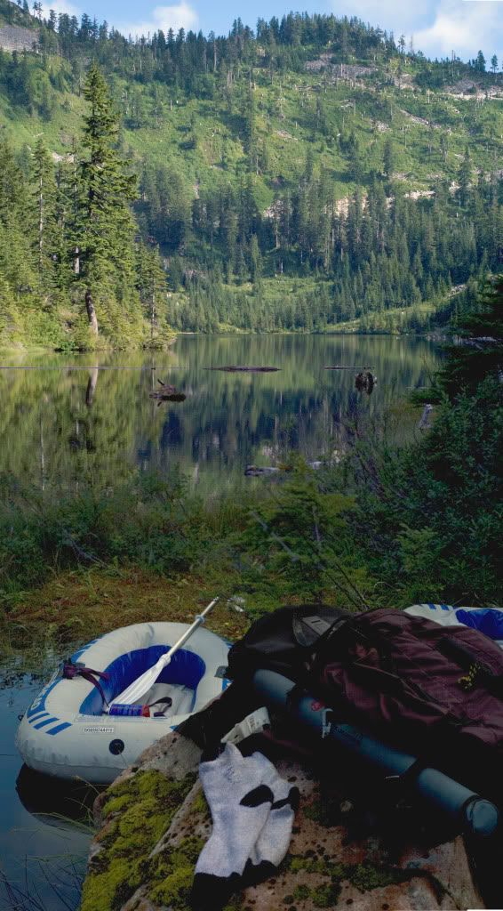
On this last Summers trip to Montana my Dad and I hiked into Slough Creek in Yellowstone Park (5 miles in,5 miles out,
8100ft. Good fun!).
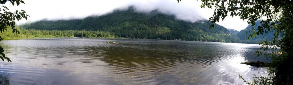
This is a view looking into the first meadow coming back from the second:
About 250 yards behind us were this pic was taken we encountered a Grizzly Sow and 2 cubs. A little unnerving, but it was more intertested in her cubs and eating Choke Cherries then chasing humans anyway.
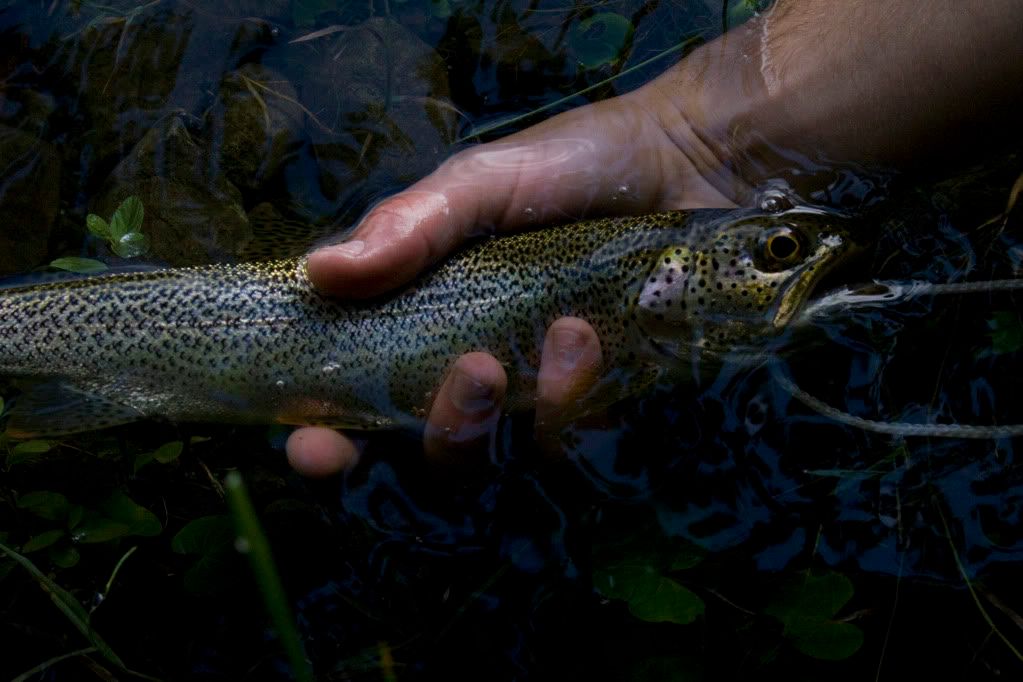
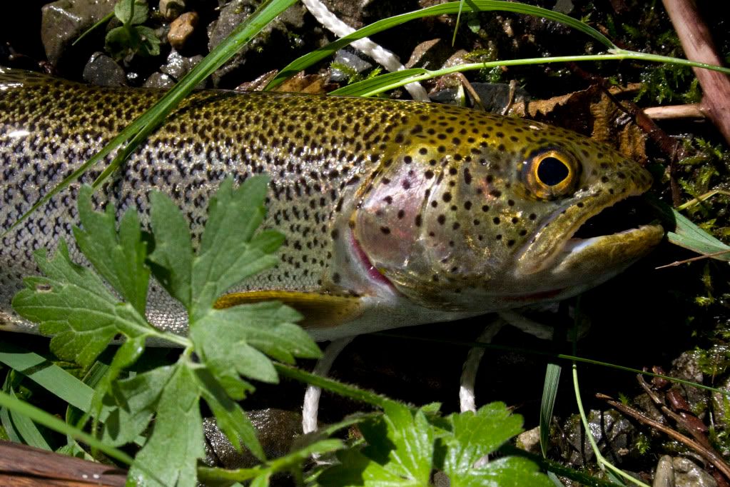
In the Creek, we caught a ton of these:
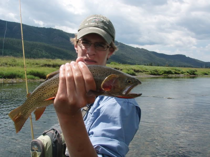
Native Yellowstone Cuttthroat Trout. As majestic as the park makes them out to be, in reality these 16-18" Cutthroats are really dumb, they eat just about anything, and don't fight very hard at all. They make Westslope Cutties look like Tarpon in the fighting department
I figured this photo captures Yellowstone Park at it's finest:
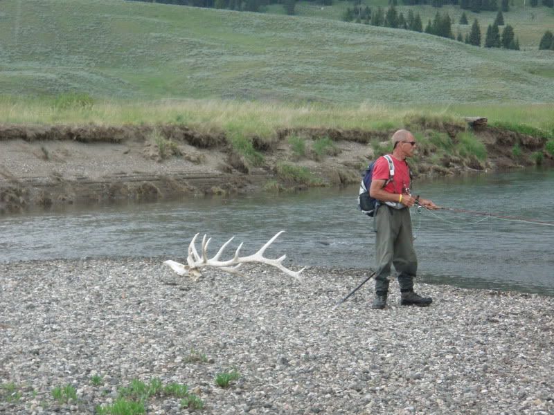
Bull Elk Skull. It's spine was down stream a ways............
RE:WL.com High lakes photo collection
Posted: Thu Oct 01, 2009 9:13 pm
by The Quadfather
SAPIplate....AWESOME PHOTOS!
RE:WL.com High lakes photo collection
Posted: Fri Oct 02, 2009 2:38 pm
by SAPIplate
Thanks man.
RE:WL.com High lakes photo collection
Posted: Sat Feb 20, 2010 6:36 pm
by Jacob
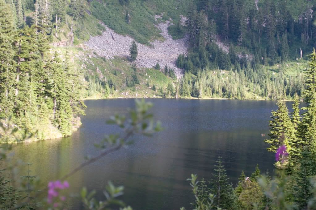
Lake Angeles, Olympic National park
RE:WL.com High lakes photo collection
Posted: Sat Feb 20, 2010 10:05 pm
by Mike Carey
great pics!
RE:WL.com High lakes photo collection
Posted: Tue Apr 06, 2010 10:17 am
by Mike Carey
OK, everyone, the pictures and overviews are updated for the Alpine lakes. Send me more when you have a chance!
RE:WL.com High lakes photo collection
Posted: Tue Apr 06, 2010 8:05 pm
by sellis_414
1st-Murtle Lake (Chelan County)
2nd & 3rd-Lyman Lake (Chelan County)
4th-Hart Lake (Chelan County)
RE:WL.com High lakes photo collection
Posted: Mon May 24, 2010 1:28 am
by bustin
Great pictured I am looking for lakes to day hike into around the Olympia area. This thread has me motivated.
RE:WL.com High lakes photo collection
Posted: Mon May 24, 2010 7:08 am
by fishnislife
bustin wrote:Great pictured I am looking for lakes to day hike into around the Olympia area. This thread has me motivated.
Just take the 101 Northwest until you get past Hoodsport and you'll have many to enjoy. Stop by the Ranger Station in Hoodsport to get all relavent information and trail openings. Plus, depending on the hike you might need to purchase a Pass.
fishnislife
RE:WL.com High lakes photo collection
Posted: Sun Sep 05, 2010 10:44 pm
by natetreat
Here are pictures I promised from the Lake Nadeau trip. 17.2 mile round trip hike straight up. That is if you don't get lost. Read the full report here
http://washingtonlakes.com/ReportCommen ... id=448&t=1
The road that leads up to the lakes.
This is the mountain we accidentally climbed. My brother motioning his disdain.
The view from Lake Hancock with the fog after we finally found it.
Lake hancock cutthroat.
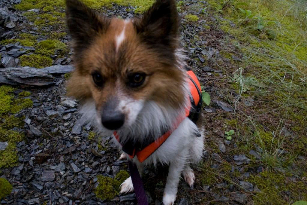
Jack Bauer in his life jacket. He hadn't gone swimming yet, he's just wet from walking in the clouds.
The view from the cliffs you hike up on the way to Lake Nadeau.
Camp at Lake Nadeau.
Lake Nadeau cutthroat.
The view on the way out from Lake Nadeau.
RE:WL.com High lakes photo collection
Posted: Mon Sep 06, 2010 8:15 am
by Mike Carey
wow, those are some great pictures. I'm going to have to check these lakes out! So it's free to hike in? Wonder if you wouldn't mind sharing specifics on the route, map, etc? I re-read your fishing report and it look like you used no GPS? Do you think proper maps and a GPS with the route plugged in would have help?
The challenge I see is there are so many roads, as you mentioned. So is it OK to park outside the gate and then walk the road? And is the shoreline of lake Hancock open to the public (besides the private homes of course).
I have "Footsore 2" by Ira Manning which decribes the Hancock and Calligan lakes hikes. Of course, it's old information as far as hours of operation by Weyerhauser, etc. But it does help. I remember trying to drive up to Hancock back in the late 80s early 90s and getting basically lost. But that was before gps and good terrain maps. I should look into it again. Thanks for the inspiration!
RE:WL.com High lakes photo collection
Posted: Mon Sep 06, 2010 8:32 am
by Mike Carey
BTW, I added a couple pics to your report and updated the Hancock lake overview with the pictures as well. I also added lake Nadeau to the database. Thanks!
Also added: Hart, Lyman (Chelan). Did not find Murtle in the USGS database, maybe a different name?? thanks, sellis 414
RE:WL.com High lakes photo collection
Posted: Mon Sep 06, 2010 12:38 pm
by natetreat
Mike Carey wrote:wow, those are some great pictures. I'm going to have to check these lakes out! So it's free to hike in? Wonder if you wouldn't mind sharing specifics on the route, map, etc? I re-read your fishing report and it look like you used no GPS? Do you think proper maps and a GPS with the route plugged in would have help?
The challenge I see is there are so many roads, as you mentioned. So is it OK to park outside the gate and then walk the road? And is the shoreline of lake Hancock open to the public (besides the private homes of course).
I have "Footsore 2" by Ira Manning which decribes the Hancock and Calligan lakes hikes. Of course, it's old information as far as hours of operation by Weyerhauser, etc. But it does help. I remember trying to drive up to Hancock back in the late 80s early 90s and getting basically lost. But that was before gps and good terrain maps. I should look into it again. Thanks for the inspiration!
Oh yes, we wouldn't have gotten lost with GPS. The route was all on the GPS my brother had just forgotten it. This is the route we used:
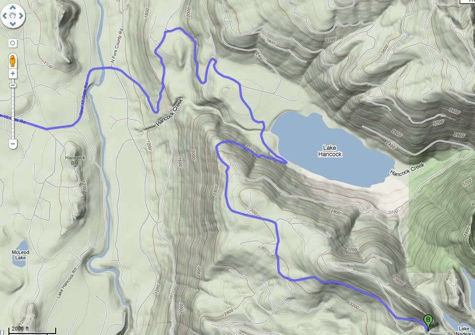
It's really only two turns onto different roads. But there are a whole bunch of new roads up there, that's how we missed the turn. Once you get past Lake Hancock it gets a lot easier on account of it isn't being logged. Yea, no fee, just park at the gate and walk in. Shoreline of the lake is open, it's really nice. No camping at Hancock, as it's on hancock land, but you can overnight on the national forest land that's Nadeau and Moolock are on. If we would have had time that would have been a welcome rest for our knees. The fish are really healthy in Hancock, and they are really hungry in Nadeau. They planted golden trout fry in it, but I think they may have been ovver run by the native cutts. There should be brook trout in smc and cutts in moolock, but I think they all have cutts now. It's awesome.
RE:WL.com High lakes photo collection
Posted: Fri Nov 05, 2010 3:54 pm
by mallard83
RE:WL.com High lakes photo collection
Posted: Fri Nov 05, 2010 4:00 pm
by mallard83
RE:WL.com High lakes photo collection
Posted: Mon Dec 06, 2010 8:43 pm
by natetreat
mallard83 wrote:All pics of Lake Isabel.
I've been wanting to hike up there for a long time now, how is it? Did you hike or float plane in? I've been turned off by all the "Closed area" signs. Gorgeous Pics though.
RE:WL.com High lakes photo collection
Posted: Mon Dec 06, 2010 8:52 pm
by BentRod
:cyclops: Mallard, those are some inspiring pictures! Thanks for sharing.
To the little kid in me, that mine entrance says "Come explore me!" lol.

At least the adult in me says "You wouldn't come out again." to keep me from doing stupid stuff like that. :safe:
RE:WL.com High lakes photo collection
Posted: Mon Dec 06, 2010 9:42 pm
by The Quadfather
What is the story on the mine? Obviously not something to play around in,,, but tease us with some history/story on the mine.
RE:WL.com High lakes photo collection
Posted: Tue Dec 07, 2010 2:55 pm
by mallard83
natetreat wrote:mallard83 wrote:All pics of Lake Isabel.
I've been wanting to hike up there for a long time now, how is it? Did you hike or float plane in? I've been turned off by all the "Closed area" signs. Gorgeous Pics though.
Hiked in every time. Extremely difficult hard to find trail. Hike is pretty long now that they closed the area to off-roading.

RE:WL.com High lakes photo collection
Posted: Tue Dec 07, 2010 3:06 pm
by mallard83
The Quadfather wrote:What is the story on the mine? Obviously not something to play around in,,, but tease us with some history/story on the mine.
Back at the turn of the century they used to mine ore out of the may creek area. There are these mines scattered all over reiter. The mine in the pic was about 3/4 the way up the last scramble to the lake far right away from May Creek Falls (basically straight up). There used to be a mining camp at the west end by the outlet creeks.
The last part of the hike is pretty much straight up and you are climbing more than hiking right next to the falls. If you pay attention you can see remnants of the old cedar plank trial the miners laid out to take the ore out in carts. All I can say is that the men back then were tough as hell.=d>